
For years, Matt, Ben, and I have talked about riding some part of the Oregon Timber Trail, but parenting and adulting schedules have made it tricky to coordinate. This winter, we committed to blocking out dates in June, and the plans started to take shape. After a few months of meandering conversations about gearing, how much food to pack, and Matt showing off his custom leather flip-flops, we were ready to depart for our grand adventure.
We opted for a late spring timeframe, thinking wildfire and smoke potential later in the summer would force us to cancel or, worse, get stuck in the woods with a fire. There are always pros and cons to anything this big, but we committed to June knowing that snowpack was light this winter and we’d likely have more chances to filter water in the mountains.
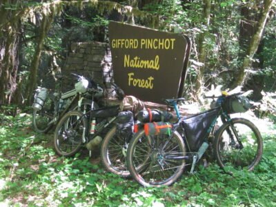
The Loowit Teir route starts in Packwood, WA, and winds its way south along the shoulders of St. Helen’s (Loowit) in the Gifford Pinchot forest before reaching White Salmon, WA, on the Columbia River. On paper, the route is 197 miles with 30k feet of climbing.
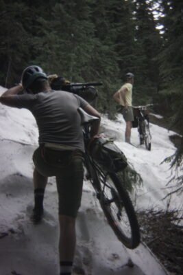
Photo by Ben Leonard
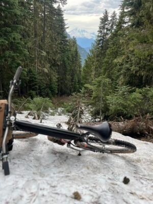
Ben’s wife dropped us off near Packwood after a substantial meal of burgers, tots, and milkshakes at the Huff n’ Puff, where Matt purchased his fresh yellow T-shirt he’d wear all week. Soon after, we were unloading our gear-laden bikes and setting off on a 20-mile gravel climb towards Goat Ridge. Aptly named. We were prepared with paper maps, but thankfully Matt downloaded the route to his smartwatch, which was helpful given how overgrown the trail was along the entire route. We found our way onto the rustic trail, where we soon had to heave our bikes over downed trees between sections of steep uphill hike-a-bike, and sections of snow where we weren’t able to see the trail on the other side. What felt ridiculous at first turned into questionable feelings about our choices. We were open with each other about doubt but also slogged upward for miles. As we pushed up the loose, loamy trail, the trees surrounding us acted as blinders to keep our gaze forward towards the trail, with only glimpses of our elevation gain visible between the trees from time to time. Our ambitious goal of 30 miles on day one came into sharp focus as we found a spot to camp near Jackpot Lake on day one. The sun setting behind us, lighting up Mt. Adams to the east as we heated water for dinner. We were worked but cautiously excited for the trail ahead.
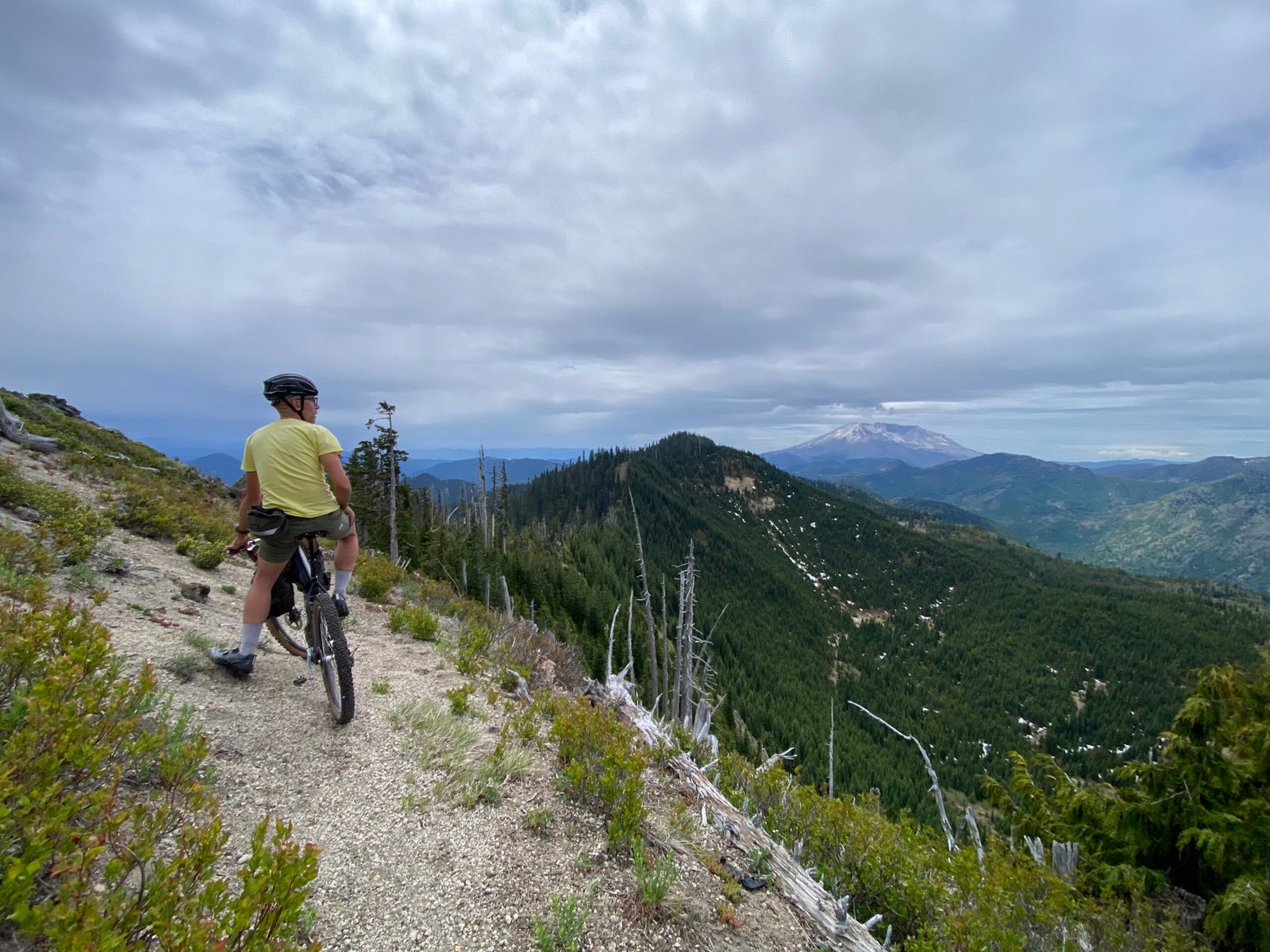
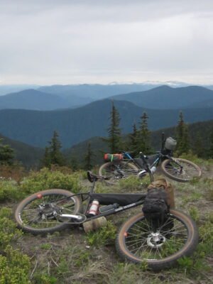 Night one was cool and dry. We woke up with filtered water for coffee, making the sunrise even better. The trail off Twin Sisters Mountain was mostly clear, which felt great with a warm belly full of oats. Pedaling along the ridgeline where we could see the northside crater of St. Helen’s in the distance. It felt remote and exciting. Wildflowers blooming along the trail with trilium and thimbleberry everywhere. The weather and temperature couldn’t have been better. We dropped down to the Cispus River, where we stopped to cool off before the afternoon sun cooked us up the long climb to Strawberry Mountain. The whole trip can be measured as a series of portals from one extreme to another. We knew the climb up to Strawberry Peak would be long, but had no idea how hard. The smooth paved road felt like silk under our heavy bikes. Pavement turned to gravel, and the gravel turned to double track with overgrown Devil’s Club and Nettle next to us. Matt’s watch told us we were on track, but our dead-end road said otherwise. Our bushwacking and snow-schlepping from day one really set the tone for the afternoon of day two. We hauled our bikes through a logging road thicket to find a narrow, steep trail up the side of the mountain. Having few details about the severity of a situation can be a good thing sometimes. We pressed upward with the trail touching 25-30 percent grades with many trees to climb over. We were gassed and realized we weren’t going to make it to the mythical water source at the top as we’d planned. We decided to stop where we were and camp for the night with what water we had. Not an ideal camp spot, but we ate food and passed out.
 Knowing we had a 4-mile push up to the lake at the top of Strawberry Mountain was a rude awakening. Ben and I skipped coffee to save water for the push-fest ahead, but Matt went all in, drinking the last bit of water he had in coffee form. We mostly walked in silence with the occasional holler to each other with encouragement. The constant heaving of my bike with all the gear led me to take off the bags and make a sling-style pack on my back with a long strap and my Austere buckle. It was uncomfortable but in a different way. Ha. Matt charged ahead, and eventually Ben and I found him on the side of the trail where the lake was supposed to be, wrapped in his rain poncho, reading his Kindle. (Yes, Matt took his Kindle!) We could see a lake down below us, but the trail was obscured by a large fallen tree. Once we scampered down to the lake, it was pleasant, and we filtered water for a proper breakfast and coffee on the trail. Our moods lifted as we sat in the dirt next to our bikes. Once we were fueled, we were able to ride the trail for a bit, where it opened up to the most beautiful ridgeline with flowers and views of Rainer, Adams, Helen’s, and even Hood in the distance. It felt great. Maybe hunger is the best sauce? After some photos and gushing about this being a top-level riding experience, we rode down the rocky trail with a dizzying drop to the left. Good practice to focus on your line!
More to come!